Thursday, February 24, 2022

To Stave Off Despair

 I have my reasons for choosing to run from Metro stations rather than to them. Mostly it is because I am gross and/or cold after I run and don't want to take the train home after a run. After my most recent terrible uphill run and my subsequent looking for long runs that aren't all uphill, I decided to change my mind.  If I want to risk the cold or dirty looks because I smell or drip on the way home, that's okay. From here on out, my goal will be to cycle, run, or walk to every Metro station from my neighborhood or home from every Metro station to my neighborhood.

So say we all.

Sunday, February 20, 2022

McPherson Square Run: The Wind Was Angry That Day

There are good runs and bad runs, my friends. This one was a bad run.

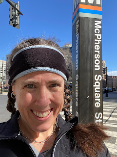
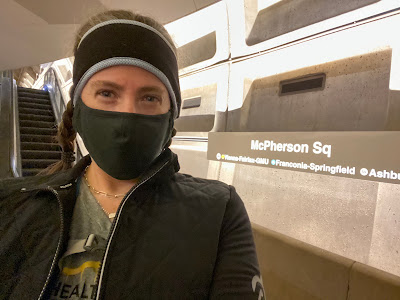
Selfie of me in front of an escalator and a sign reading "McPherson Square"
Pre-run. Look at the optimism in my eyes!

I was excited for this one too. I had an easy 10-mile run scheduled for this week and I figured I could run straight up Connecticut from downtown DC to my neighborhood. 

"Ugh, that'll be all uphill," said Alex, who drives Connecticut two times every day.

"No, it's more of a rolling hills situation," said I, who runs on Connecticut every once in a while.

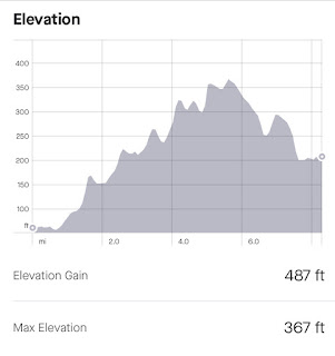
Elevation map showing a few downs, but mostly up, up, up.
Guess who was right?

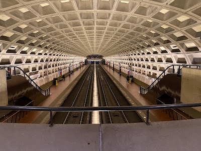
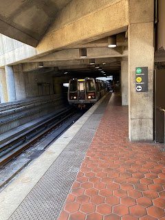
Let's just let that sink in for a while as we get to know McPherson Square. This Metro station serves the Orange, Silver, and Blue Lines and is located in downtown DC. It is a two-platform indoor station with an excellent viewpoint for photo taking.

Photo of both platforms of the Metro station from above.
Weirdly, there were two other people taking similar photos at the same time.

It's not a hugely remarkable station in any way other than its proximity to some cool places, but it does have some art on the wall to commemorate veterans.

Red-toned mural
There are other panels I didn't photograph because there was a homeless guy sitting in front of them and I didn't want to be an asshole.

There was also a pigeon, which I mention because I didn't see any crows, but pigeons, while less smart than crows, are similarly delightful in their scavenging and willingness to hang out near humans.

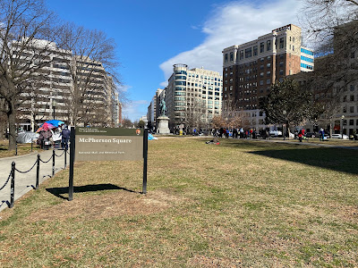
This station is located near McPherson Square. Which seems obvious, but not everything in city planning in obvious. McPherson Square is named after James B. McPherson, who was a major general in the Union Army during the Civil War.

Photo of McPherson Square with a sign in the forefront identifying it as such. You can see a statue.
There's a statue of the guy right back there in the middle.

McPherson Square is similar to lots of other downtown DC park-like blocks. Fun fact: I work right near here!

There are a lot of cool places to see near here, including the White House and Black Lives Matter Plaza. There is also the Subway sandwiches shop where I bought an oatmeal cookie so I could use the bathroom. Fun fact: This is the Subway sandwiches shop where I buy my morning fountain soda to take to work!

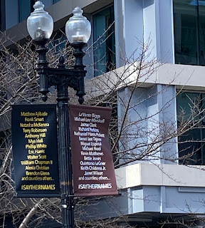
A lamppost with brown and black banners on it with lists of victims of police violence and the hashtag #SayTheirNames
Banners at Black Lives Matter Plaza

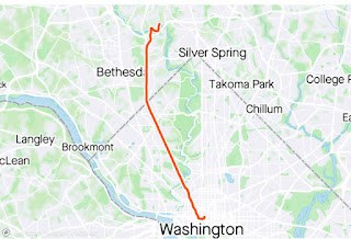
I took a quick little run tour of the sights and local bathrooms, then headed over to Connecticut Avenue to start my run home. I'd show you a picture of the map, but it's really just a straight orange line. 

Screenshot of a map of DC/Maryland with an orange line leading straight out of it.
I can't not do it, for some reason.

Anywho, I set off UP Connecticut and soon discovered that the wind advisory put out by the National Weather Service was put out for a reason. That wind was not fucking around and it was right in my face the entire way. It was genuinely A Thing.

I don't know if it was the hills or the wind or I was just tired and burnt out, but this run was grueling for me. I also had a hard time finding my groove because running out of DC involves a lot of stop lights. I was way sad by the time I hit three and a half miles. Mile four was a tough one.

I made it all the way to five miles before I got sad enough to sit on a bench and feel bad about myself and my life choices. During this sit, I watched a metal sign across the street be battered and shook by the wind and I felt devastated for it and myself.

Selfie of me making a face.
This is the face of someone only halfway through a run she really doesn't want to do.

I texted Alex for encouragement, which went unanswered (evidently he has his own life) then decided I should keep going at a slow run with some walk breaks thrown in. I already wasn't going to get ten straight running miles in, so I decided to at least bank some time on my feet. I was also approaching the part of my run that was less extremely uphill.

I pulled my shit together and shuffled up the street again. There was a minor car crash blocking the road at one point, so for two amazing blocks, I was moving faster than the traffic. I was blazing fast! Or not.

Screenshot of my splits from mile 1 to 10. They rance from 12:09 to 18:14.
I'm not proud of this.
Eventually I made it close enough to my house to give up. I had apparently done some wacky pausing of my watch or maybe I paused it a stoplight and forgot to turn it on for a while, but that watch said I only went just over eight miles.

I gave not a single fuck.

I was very proud of myself for pushing through and making it home on my own feets. I figure that every training cycle has at least one terrible run. I'm hoping this one was it for this cycle. There are plenty of Metro stations that can let me run up Connecticut. Maybe I'll try again someday, but for next week I'm going to try running somewhere other than the "rolling hills" of Connecticut Avenue.

STATS:

Selfie of me in front of the McPherson Square Metro pillar.


Metro station: McPherson Square
Line: Orange, Silver, & Blue Lines
Distance: 8.31
Time: 1:44:03
Pace: 12:31
Crow sightings: 0
Interesting tidbit: These stats reflect my run time/pace/distance. My elapsed time/pace/distance was different. It was longer, for sure, but it also included a fair amount of (watch paused) moping time, slowing my pace down significantly.

Wednesday, February 9, 2022

Fort Totten Run: Not Quite Far Enough Away

 I am currently training for a half marathon, so I am finally running long enough to make it home from Metro stations. In fact, when I arrived at my end point for this run, I still had another mile to run and had to do a little out and back loop after the route I'd planned. My required mileage for this week's long run was 8 miles, so I chose Fort Totten, which turns out to be 7 miles away from my neighborhood.

 Fort Totten is on my regular commuting route, so I see it a lot. It is also the transfer station closest to my house, so if I am switching Metro lines, this is often where I do it. Ergo, I am very familiar with this station.

That said, I just uncovered a ton of veeeeerrrrrry interesting information. But first, the basics. Fort Totten is a three-story open-air station with the Red Line running through the top and the Green and Yellow Lines running through the bottom. It is the last DC Metro stop before the train enters Maryland.

Red Line Metro train leaving an open air station with a Fort Totten sign
Red Line leaving.
Green Line Metro train exiting a tunnel into the Fort Totten Metro station
Green Line arriving.
In 2009, there was a terrible accident when a train headed to Fort Totten during rush hour hit a stopped train in front of it, resulting in nine deaths and at least 80 injuries. There is a memorial plaque in the station, but I have never noticed it, only learning of its existence from the station Wikipedia page. I remember when this accident happened. It was awful.

Deep cleansing breath.

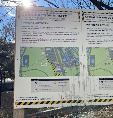
On my commute, I have watched a the progress of a trail expansion happening at the station. I so badly want to run on that clean, new trail. It looks really exciting.

Photo of a sign explaining where the construction is and how it affects pedestrian and bike access
It's hard to see the trail from the platform, so this map will have to do.

Before I get into my run, however, here's something interesting: In an article published -- oh shit -- today, it was reported that an unexploded shell discovered in the construction area last summer is -- again, oh shit -- a chemical fucking weapon. I'm not quite sure what that all means, but it seems to be connected to the Spring Valley cleanup, which I am uninformed about, but was apparently undertaken at a site referred to as "the mother of all toxic dumps." Huh. It'll be interesting to see how that shakes out.

Deep cleansing breath.

My run path was a zigzag north and west, taking me to 16th Street, which I ran out of DC and into Silver Spring.

Strava map of my route. It leads up and left out of DC into Maryland
I switched from Garmin to Strava and I'm not sure I like this map.

The path itself was okay. But the thing that was exciting was my elevation graph. Fortunately, I was supposed to be running slow and easy so it wasn't too rough.

Graph showing a jagged up and down elevation graph with an elevation gain totalling 545 feet
Am badass.

There were stairs -- STAIRS -- on my sidewalk route coming into Maryland. Then there was a lot of fun downhill. 

Once I realized how close I was to my home, I was a little concerned, because my training plan said I had to run 8 miles and I was sure I was only at 5+. Happily, when I checked my watch, I was actually at 6+, so by the time I got to my neighborhood, I only had to run an extra one mile instead of two. That said, it was incredibly sad to bypass my usual exit point and have to run another half mile out and half mile back.

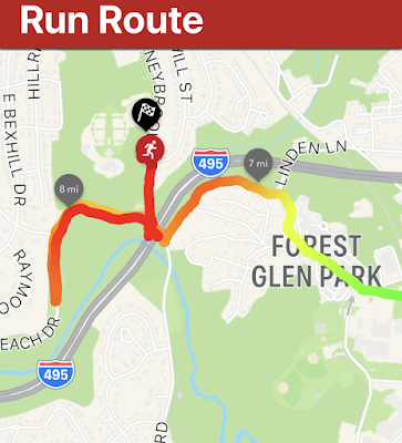
In addition to Strava, I have the Zombies, Run! app going on my phone during runs, so I have a more detailed map of that last, oh-so-sad mile.

Screenshot showing my path back and forth. The line indicating my path becomes steadily darker as I close in on 8 miles.
See how I got steadily slower, as indicated by the line turning from green to dark red?

I have a Project Crow run planned for my 9-mile long run next weekend, but I am planning a route of 9.5 miles to make sure I don't have to take that dispiriting mile jog at the end. See you then!

STATS:

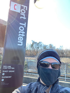
Photo of Jean wearing a mask standing in front of a Fort Totten tower sign

Metro station:
Fort Totten
Line: Transfer station for Red, Green, and Yellow Lines
Distance: 8.01 miles
Time: 1:40:28
Pace: 12:32 min/mi
Crow sightings: Two and a half! I saw two crows at my boarding station and I heard a crow on my run but couldn't locate it. So half.
Interesting tidbit: Alex (husband) was also going on a run when I was. We started in radically different spots, we run very different paces, we ran different mileage, and we started out in different directions. The road I was on at mile seven and the road he was on at mile nine intersect with each other and we both hit that intersection at THE EXACT SAME TIME. It was crazy weird.


Tuesday, July 27, 2021

Twinbrook Run: Back at it!

Well, it's been a while, hasn't it? Skipping October 2019 through March 2020 is all on me. But then, you know, COVID. When, just like everyone else, I figured that the best way to catch COVID would be to ride Metro, I decided to table Project Crow during quarantine. I started back commuting on Metro this month, so it seemed like the right time to get back on the rails for fun too.

I did this run July 11 and then forgot that I actually have to write it up. Sorry. My long runs these days are about 5 miles so I chose my station based on distance from my neighborhood. I was limited in my options. 

Twinbrook Station is on the Red Line in Rockville. It opened in 1984 and has an outdoor platform. 

Photo of concrete opening to the Twinbrook Station
It's not really that exciting of a station.

It is near a bunch of new eateries that have sprung up in the past couple of years and you can easily walk from it to all kinds of places on Rockville Pike. 

There are two exits to and from the station and both feature parking and bus service. So many options! 

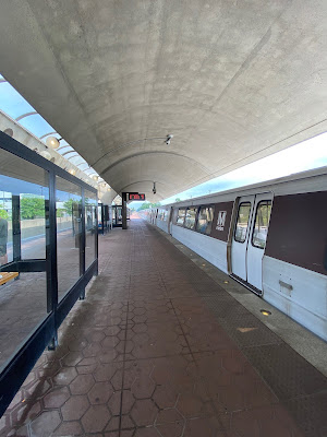
Photo of a Metro platform with an arched roof and a train idling.
The platform

There isn't a lot to say about this particular station, so on to the run! I was very excited about this run because there were some trails on the way home from this station that I hadn't run on since I'd been injured and I sorely missed them. 

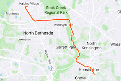
Map of my run, described in the text below.
I love running one-way routes.

I ran down Rockville Pike, hung a left on Randolph, and continued until I was able to join Rock Creek Trail. It was only about 10am, but the humidity was at, like, 62 percent, so it was pretty hot.

Selfie of me in front of a green sign for Rock Creek Trail.
As evidenced by my sweatiness and redness.

I was so happy to run on those trails. Also, there are parks with water fountains along the way, which is really nice for a hot day. I stayed on that path all the way to Knowles Avenue, then I turned left and started running up it. Then I did some walking. Then I tried to run more. Then I walked. Then I shuffled. 

Elevation graph of my run. Most of it is downhill, with a steep section on the first half. There is a steep uphill in the last 20% or so.
You can see Knowles as that last hill there. Otherwise the elevation was kind to me.

That's about it. Eventually I arrived at my neighborhood, triumphant, happy, and tired! I'm so excited to finally be back to it and I'm looking forward to exploring more stations!


STATS:


Metro station: Twinbrook
Line: Red Line
Distance: 4.91 miles
Time: 56:00
Pace: 11:24 min mile
Crow sightings: *sniff* none *sniff*
Interesting tidbit: There is but one escalator from the station entrance to the train platform. It is usually going up. You have to use stairs (or an elevator) to go the other way.

Thursday, September 26, 2019

Forest Glen Cycle: I Can Ride a Bike!

I'll be honest here. I mostly included cycling in Project Crow because I needed a "C" for crow. I've had a bike for a while, but I rarely ride it. I want to be a cyclist, but I'm all kinds of scared about it. But I've had a shin injury recently that has kept me from running at all, so if I have any plans to Crow about DC, I'm going to need to get on my bike.

The thing about cycling home from a Metro station is that you have to take your bike on the Metro to get to the starting station. I decided I didn't want to have to jam my bike into my minivan and drive to my home Metro station, so I decided my first bike excursion would be to figure out exactly how the hell to ride from my neighborhood to Forest Glen. Unfortunately, the roads between there and my home are not bicycle friendly. I rarely see cyclists on them and there are cyclists who ride everywhere!

I deduced that there have to be other ways to get to the station without taking a million-mile detour around Wheaton to get there so I took to Google Maps and did some close-up inspecting of the satellite images to find a route that avoided Newcastle Avenue from one direction or Capitol View Avenue from the other. I thought I'd found a good route that would put me on Capitol View for only about a block or so, which is terrifying, but doable. But then! I found a cut-through that wasn't even on the map version of Google Maps, but was visible on the satellite view and I managed to avoid Capitol View altogether except to cross straight across it. If you ever drive on Capitol View Avenue, you understand why this is a good thing.

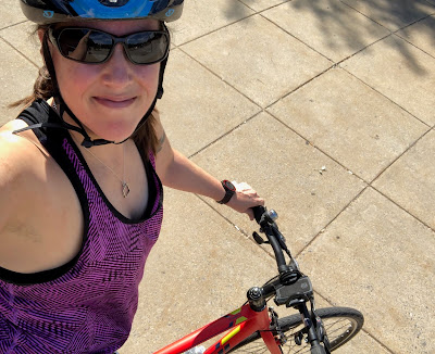
Selfie of Jean in a bike helmet. You can see part of the bike she is sitting on.
It's hard to take a selfie that shows both you and your bike.
I recently switched from flat to clipless pedals and this was to be my first ride using them. I'd practiced unclipping before and found that the kind of pedals I purchased release when my leg makes a panicked "oh shit, I have to put my foot down immediately" motion, so I felt okay about venturing out of my driveway in them. Spoiler alert: I didn't fall down once.

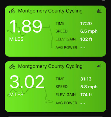
My journey to Forest Glen was more than a mile longer than my return trip. This is because I did a quick trip around a parking lot first to make sure I could still ride a bike (I can!) and I made some wrong turns. I also forgot to turn off and restart my Garmin right at the Metro station so my ride home was a little shorter than it should have been.

Screenshot of two ride summaries; the top is 1.89 miles in 17:20 at 6.5mph and the bottom is 3.02 miles in 31:13 at 5.8 mph
The top one is the ride from Metro to home; the bottom is to the station.
I could not have felt more proud of myself. It is very scary for me to do something so new on an unfamiliar path by myself. And I did all of it. Go me! I got a lot of practice switching gears because my route was very up and down. I don't think it was all that steep or hard, but I definitely got out of breath and sweaty. It felt awesome.

My pace wasn't great either direction because I stopped now and again to look at maps, cross roads, take photos, or walk my bike up/down a couple of very short steep sections. I'm okay with that.

Elevation chart showing rolling hills.
This was elevation just for the actual Crow ride (from the station to my neighborhood).
My route was pretty convoluted. Honestly, the hardest/most stressful part was crossing Capitol View. Other than that, I rode through quiet neighborhood streets. Leaving Forest Glen, I headed away from Forest Glen Road and into the neighborhood behind the station. From there, I went through McKenney Hills Park, which I'd never been to before. I did have to dismount to walk my bike across a narrow bridge on which there were numerous children and their adults. I'm new to bike etiquette, but zinging past them and probably mowing down a few because of my inexperience seemed unwise.

A map of most of my route
My route.
I actually really loved this. I see more of these rides in my near future. I just have to make sure I find more stations accessible by small, unbusy neighborhood streets because I don't want to get hit by a car.

STATS:

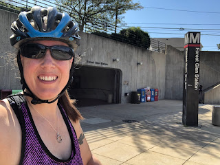
Photo of Jean in a bike helmet in front of the Forest Glen Metro station entrance


Metro station: Forest Glen
Line: Red Line
Distance: 1.89 miles
Time: 17:20
Pace: 6.5 mph
Crow sightings: Not a damn one.
Interesting tidbit: It actually took me longer to bike this route from Forest Glen than it took me to run a different route from the same station!

Tuesday, May 21, 2019

Columbia Heights Run/Walk: Trails, Paths, and, Oh! Look! More Trails!

I have been delinquent. I did a Project Crow journey weeks ago and haven't told you about it yet. I guess sometimes it's easier to do the physical work than the mental. Not that this particular trip home from Metro was easy. In fact, I had to create a whole new category for it: the Run/Walk.

So, what station? I chose the illustrious Columbia Heights Metro Station on the Green Line, disembarking just four days before someone was stabbed at the station in the middle of the goddamn afternoon on a fucking Tuesday. I went looking for more information on said stabbing and was aghast to discover that the stabbing was fatal and done with a screwdriver, before I realized that in fact the latter information was about a stabbing at the Columbia Heights Metro Station in July 2018. Then I made the mistake of Googling Columbia Heights metro stabbing, found more stabbings, and decided to stop investigating Metro station stabbings altogether.

To begin again: Columbia Heights! What a great station! Evidently this station is one of the busiest Metro stations outside of the downtown core with more than 12,000 exits on weekdays and nearly 16,000 exits on weekends.

Photo of the glass roof, stained glass decorations, and concrete walls of the Columbia Heights Station West Entrance
Pretty. And not a screwdriver in sight.
Based on my exit from the station, I believe those numbers. The area was absolutely packed. There were people playing music, vendors selling food and crafts, many shopping destinations, and so very many people milling about. I also saw this cat/astronaut.

Photo of a woman carrying a hard-shell pink frontpack with a window in which you can see her cat's head.
Catstronaut?
It looked like a hoppin' neighborhood. I headed down Irving Street toward the zoo because I wanted to find some of the trails that run through Rock Creek Park that I'd never run on before. I came to the end of Irving Street and immediately got lost and wandered in circles for a bit. Once I found the path I wanted to take, I ran down it for a couple of minutes before I realized that I'd run that direction on that path before, but at the time I'd been running away from my house, so I turned around and ran the other direction.

I wasn't entirely sure how I was going to get home. I'd made a decision to head into the park and run north until I found Maryland. I've run a similar route south into DC often, so I figured that, worst case scenario, I'd just run that in reverse. I came to a literal fork in the road about a mile and a half in when I saw the path I knew go one direction and the path I didn't know go another.

Photo of a sign in a lot of greenery. The Valley Trail points one direction, the Western Ridge Trail another.
Refrains from road less traveled joke here.
I headed off down the Western Ridge Trail, not knowing what to expect. Shortly thereafter, I got a hint when I came across this sign:

Photo of a sign that says "Western Ridge Trail." There are arrows pointing in opposite directions, one says "Strenuous" and one says "moderate."
It's almost like the sign was throwing down a dare.
You guys, the "moderate" arrow was pointing to an uphill trail and the "strenuous" arrow was pointing to a gently downhill sloping trail. Being an unthinking asshole, I passed a hiker to sprint down the strenuous trail. Shortly thereafter, when the trail took a sharp upturn and I realized that running up it was unlikely (for I was still planning on running this route at that time), I had to turn around and re-pass the same hiker on my way to the easier trail, while muttering, "I've made a huge mistake."

It turns out the "moderate" trail was not all that moderate. This seems as good a time as any to explain why this turned into a run/walk instead of my planned run. 
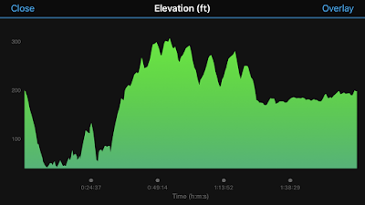
graph of the elevation of my run. There is a lot of up and down, especially at the start.
There were stairs on the trail, people. STAIRS.
I tried to run as much as possible for a long time, but eventually I realized that I could no longer in good conscience refer to this as a run. However, I'd already run (and continued to run) more than I would on a walk, so I created a new Crow category. Deal with it.

The moderate and strenuous trails met up before too long and I managed to stay on trails that I'd never run on before. I'd actually been really excited for this route because I've driven on roads that run near these trails and paths many times and I've always wanted to put foot to dirt and asphalt on them. I was delighted to find that I had quite literally stumbled on to them.

This route wasn't the easiest, but I really, truly enjoyed it. There were enough water fountains and spigots that I ran into along the way to keep my water bottle filled and it was maybe the prettiest run I've taken through DC.
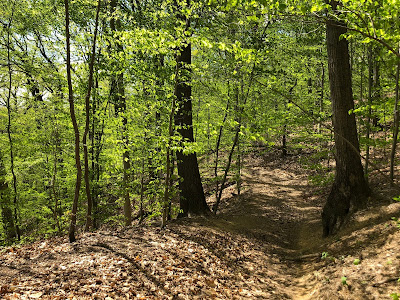
Photo of a dirt path through bright green trees.
I mean, come on.
At times I did feel like I was on the very trails that that hapless jogger who finds bodies runs on. Mostly I just found people with dogs. (Phew.)

Rock Creek Park kind of floors me. It is incredible to me that there is this giant, gorgeous park right in the middle of DC that seems miles away from everything. There was a 10-15 minute stretch where I literally saw no one. Literally. Where in DC can you say that?

I was pretty sure that I was headed in generally the right direction, but I was still happy to find a sign indicating that I was approaching my home state.
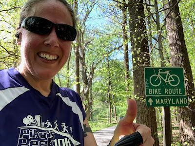
Photo of me giving a thumbs up next to a bike route sign indicating that Maryland is thatta way.
Maryland is thatta way!
Eventually I popped out of the woods at the DC/Maryland line, which is a turn-around spot for a lot of my local runs. Victory! But then I still had to run three miles to get to my neighborhood.
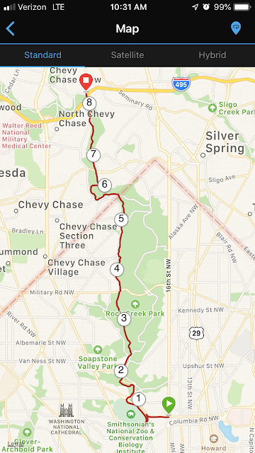
Screenshot of a map of my route.
A nice little jaunt, if I do say so myself.
I'm so happy that I challenged myself to take a different route than usual. In fact, I might even do this route again and try to run the whole thing. I love that I can run 8 miles through the heart of the DC area and touch almost no roads. I might even branch off these trails onto new trails. There is a lot of park to explore out there!

STATS:

Selfie of me in front of the Columbia Heights Station sign

Metro station: Columbia Heights
Line: Green Line and sometimes Yellow Line
Distance: 8.37 miles
Time: 2:03:08
Pace: 14:42 min/mi
Crow sightings: Sniff. None.
Interesting tidbit: There is a Target right next to this station, which meant I could use the bathroom before I started running. Game changer, right there.

Saturday, March 23, 2019

Glenmont Walk: A Long Walk on a New Path


I have been working out pretty hard lately and hadn't taken a rest day for a while, so I decided that I should do my first Crow Walk on March 17, 2019, from the Glenmont Metro Station. It turns out, however, that Glenmont Station is seven and a half goddamn miles from my house, so I don't think that counts as a rest day even though I was walking.

Glenmont Station is the last stop on the Red Line. I had been to this station once to buy a special Metro card for the second Obama inauguration, but I'd never taken a train there. Upon first glance, it was much like every other Metro station in existence. Wikipedia seems to think it is of note that Glenmont is the only Red Line station to have a six-coffer design, leading me down a rabbit-hole that started with "what the hell is a coffer," and ending with "I have so many questions about coffers."

Photo of the platform of the Glenmont Metro Station with a train waiting.
I could only find evidence of four coffers for the longest time until I realized that the train was blocking one of them.
The Glenmont Station was planned ever since the first layout was approved in 1968, but wasn't actually opened until 1998 due to a morass of bickering amongst politicians, political bodies, and businesses. I could go into it—and it is actually kind of interesting and dramatic—but I don't know that I really need to considering you can go to the Wikipedia page that lays out the whole story in more detail than I would. Also, my eyes kinda glazed over during parts of the story, so I'm not sure I fully understand it.

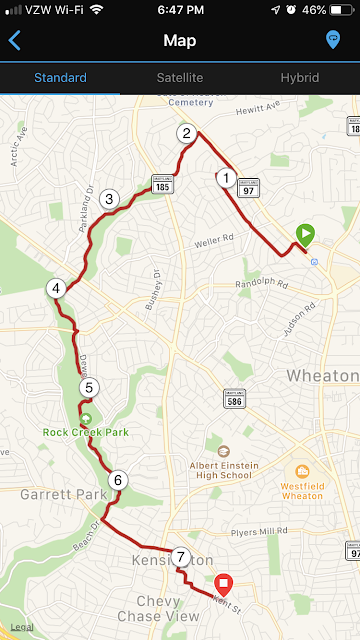
What I do understand is that Glenmont is not actually 7.5 miles from my house as the crow flies (ha!). But I wanted to take the Matthew Henson trail to the Rock Creek trail and that is what added all the mileage.

Map of my walk including mileage notations.
I recently figured out how to show you this map instead of a tiny thumbnail and am feeling preeeetty proud of myself.

The Matthew Henson trail is almost two miles away from the station, but you can get there without walking down Georgia Avenue, which is where Glenmont Station is. I walked through neighborhoods for about a mile and then doubled back to Georgia, because I wanted to spend the most time on the trail that I could.

You guys. People throw a TON of trash onto the side of Georgia Avenue. It's kind of a bummer. If anyone wants an old-school TV, I know where you can find one. I was very happy to arrive at the Georgia Ave trailhead so I could make a left turn off of the trash heap.

two photos, one a selfie of me in front of the sign for the trailhead and one of the trail itself.
Most of the trash on this trail was empty beer bottles. People are the worst.

The walk itself was really nice. It was a gorgeous day, as you can see. It was warm enough that my capri leggings and light jacket were fine, although cold enough that eventually I wished I'd brought gloves because evidently walking doesn't warm up your hands all that much.

I'd never walked the Matthew Henson trail—and I LOVE checking out new-to-me running routes—so I was excited to check it out. There was even a trail-side informational display about Hanson, who I'd not thought about at all, but turned out to be very interesting. He was a Maryland-born black explorer who adventured with Robert Peary and planted an American flag at the North Pole in 1909.

On that same display there was also a set of instructions for walking on the trail that included the wise suggestion to "keep alert for surprise actions by dogs and children." Very sage advice for pretty much any day in your life, honestly.

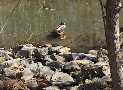
Sadly, the day was yet another day without crows, but I spent a chunk of time watching three vultures circling the trail. They were pretty cool. I also found this fun, colorful little duck:

Photo of a duck (a mallard?) on a rock in the creek.
I forgot to quack at him.

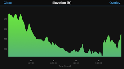
Eventually this trail dumped me onto the Rock Creek Trail, which is very familiar to me. I stayed on it until I hit Knowles Avenue and walked up it into Kensington. The elevation on this walk was easy and fun and felt mostly level (except for those two hills at the end).

Elevation map spanning about 400 vertical feet. Much of it was downhill.
The break in the graph at about two hours is where I paused my Garmin at a stoplight and forgot to turn it back on right away.
So there we have my first Project Crow walk. Interestingly, I don't walk all that much slower than I run. (I mean, I do, but I expected each mile to take about 20 minutes. Even with stopping to gawk at signs and birds, I was only slightly over 18-minute miles.) My final review of my route: If you live in the area and haven't traveled on the Matthew Henson trail, I highly recommend it.


STATS:

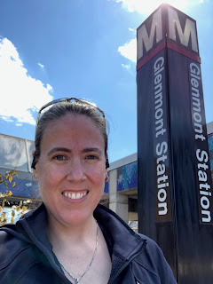
Photo of me outside standing in front of a Glenmont Station sign


Metro station: Glenmont
Line: Red Line
Distance: 7.51 miles
Time: 2:17:59
Pace: 18:23 min/mi
Crow sightings: None, but I saw vultures and a delightful duck.
Interesting tidbit: I found some fun online reviews for the Glenmont Station, including "staircase smells like pee every time," "fuck the red line!" "you can literally get away with anything on the 3rd floor of the garage," and the super descriptive and very helpful, "farecard machine."